Shoreline Trail: A Fair Weather Hike
| Name: | Shoreline Trail |
| Type: | Loop |
| Trailhead: | Colter Bay Marina |
| Map: | Alltrails |
| Round Trip Length: | 2.5 miles |
| Time: | 1.5 Hours |
| Nearest City: | Moran, WY |
| Best Time of Year: | June – September |
| Elevation Gain: | 85 feet |
| Highest Point: | 6,817 feet |
The Colter Bay shoreline trail is the most leisurely hike in Grand Teton National Park, assuming the weather is on your side and mosquitoes don’t eat you alive.
The trail is laid out in a 2.5-mile figure-eight loop. While the name might fool you, the path doesn’t always follow the Colter Bay shoreline. The trail also ascends and descends through a dense forest of pine trees. Don’t worry, though. The elevation gain is only 85 feet, making this a pleasant stroll for just about everyone.
Shoreline Trail is a great beginner hike if you are new to hiking or just new to Grand Teton National Park.
Prepare and Be Aware
Bug spray is a necessity on this trail. Of all the days we spent and trails we hiked in Grand Teton National Park, this was the only spot where we got eaten alive by mosquitoes. I’m talking big nasty bloodsuckers here.
Mosquitoes aren’t the only wildlife that can give you a problem here. Black Bears are often spotted crossing the trail to gulp a glass of lake water. So as peaceful as the forest tranquility is, be sure to make some noise and alert the woodsy creatures to your presence while you walk.
Other than animals and insects that can do you harm, the area also has lots of deer, birds, and other lovely creatures for your viewing pleasure.

Shoreline Trail
The shoreline hike begins at the marina near Colter Bay Village. The village is a popular area with campgrounds, beaches, and a cafe/restaurant.
The early parts of the trail have you following a wide gravel road lined with towering Aspens trees. You can see the Colter Bay Marina through the skinny gaps in these tall trees.
Whether you started your loop left or right, the trail eventually comes to a short land bridge that connects the figure eight and leads you out to the second “Island.” Your view opens up as you cross, and there are excellent views of the lake on both sides of you.

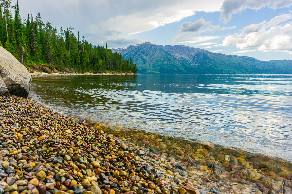
From the connector, you’ll enter back into the trees and start your short ascent. The views from here are partially obstructed, but once you reach the backside of this loop, there are some secluded beaches where you’ll have a better chance to grab photos of the mountains and lake.

You’ll complete the loop when you end up back at the island connector. Cross back over and head continue to walk on the part of the trail you have not done yet. This will complete your figure-eight loop and bring back to where you started.

Our Thoughts
While walking along the rocky lake beaches, you’ll have great views of the Teton Range and Jackson Lake. I will admit the views lose much of their attraction when it’s cloudy and overcast. I would say if the weather isn’t cooperating, this is a skippable outing. If the weather is on your side, this trail offers a great spot to catch the sunset over the mountains. Just remember to bring bug spray!
If you looking for another easy hike in Grand Teton National park check out our trail guide for Jenny Lake.
Trail Tips
- Bring bug spray ( I cannot stress this enough)
- Be Bear Aware and carry Bear Spray at all times


No responses yet