
Trail Details
- Type: Loop
- Trailhead: Celebration Park
- Length: 4 miles
- Time: 2 hours
- Nearest City: Melba, ID
- Best time of year: January
I think I’ve mentioned it before but I love Idaho for its diverse regions. No matter what time of year it is you have hiking options. Hike north in the winter time and your sure to encounter snowy mountains and dense forests, but if snow is not your thing, hike south and find yourself traversing over sweeping plains and canyons spotted with 10,000 year old petroglyphs. I have been actively avoiding the snow these past couple weeks as my truck and I will be parting ways (a story for another time), so I have been exploring southwest Idaho, where fallen snow tends to disappear much quicker then the northern mountainous region.
I surprisingly found the Guffey Butte hike based off a recommendation from a calendar I have that lists the top two hikes in Idaho to do every month. For being one of the top hikes to do in January, I had a hard time researching this one. The trail here is scarce at best, it ends and begins constantly leaving you having to stop and figure out which way to continue. I ended up just planning my route based off what looked like a trail on Google Earth. But because it is such a wide open hike, you can really just pick a point at the top and go, which is what I ended up doing.

Old Guffey Railroad Bridge
The trailhead for this hike is located within Celebration Park. DO NOT use Apple Maps to guide you here. I spent an hour driving in the wrong direction as Siri guided me to the wrong side of the Snake River, down a private dirt road to a house with clear markings that trespasser’s were not welcome. Based on the bullet holes in the sign, I’d say I wasn’t the first to make this mistake. So I hightailed it back to the main road and drove around until I could get a cell signal, which I then pulled up a map and did things the old fashioned way. After writing down the directions, I eventually found my way to the park and pulled up next to the old railroad bridge where the hike starts.
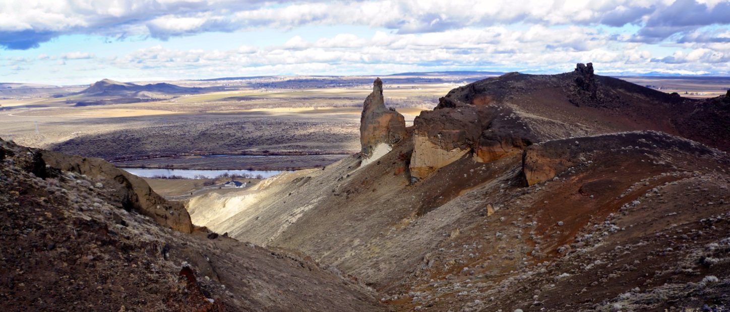
Right after you cross the railroad bridge you take a steep dive down a dirt trail and then begin your ascent. I saw small traces of snow where the butte blocks the sunshine, but other than that, the beginning part of the trail was in pretty good shape. After about a mile in, the trail split to begin the loop I had mapped out, quickly after that I lost the trail. There is no prominent peak on a butte, so my best course of action was to just head upwards until I reached flat land. To be honest, I couldn’t tell if I made it to the designated viewpoint or if there even was one. I just hiked until I felt like I had achieved the best view.

Northern View
When I stopped to take in my surroundings, my uphill climb was validated with a 360 degree view allowing me the opportunity to view the exact diversity Idaho climates offer. With the rewarding view of the snowcapped Sawtooths to the north and jagged canyon cliffs to the south, I had to agree with my calendar, Guffey Butte is one of the best hikes in January.
So what did I learn?
- Don’t trust Siri
- Sometimes it is just easier to make your own trail


No responses yet